Chain of Wetlands
Latest Trinity Bird Count Info
Included as a major part of the Dallas Floodway Extension Project is the development of a series of wetland ponds built to reduce flooding and provide ecosystem restoration. The two projects are: the Upper Chain of Wetlands (57 acres) and the Lower Chain of Wetlands (75 acres). The two wetland areas will work together to lower flood levels by as much as four feet in the urban corridors of Dallas during overbanking by the Trinity River. The Wetland Chains and this new corridor will encompass a four mile area stretching from Cedar Creek at the north end of Cadillac Heights to the Lower Chain of Wetlands.

The largest of this group, Wetland Cell G, located just downstream of Interstate 45 South will act independently as CWWTP treated water will pass through and directly into the Trinity River.
Photo By: Judy Schmidt

Lower Chain of Wetland Map
The wetland chains function through the series of ponds that are linked together and are continuously fed by discharge (or treated water) from the Central Wastewater Treatment Plant (CWWTP). The U.S. Army Corps of Engineers (Corps) working with the Lewisville Aquatic Ecosystem Research Facility planted thousands of native aquatic vegetation around the Lower Chain of Wetlands and will begin the same process Winter 2016/2017 for the Upper Chain of Wetlands.
To help keep the flood protection aspects of the wetlands in tact and to provide an environment more conductive to recreation, the Corps installed a pipe fence around the parking lot to keep vehicles out of this area to deter people from dumping trash and debris in this vital environmental place within the Great Trinity Forest.
Reducing flood water levels is the main purpose of these projects. Some flood-risk reduction has already been achieved.
The Dallas Floodway Extension Project's ecosystem restoration uses an adaptive management approach in the Chain of Wetlands led by the Corps' Engineer Research and Development Center's Lewisville Aquatic Ecosystem Research Facility. The wetlands consists of 271 acres of improved, managed habitat as follows: 123 acres of emergent wetlands, 45 acres of open water and 102 acres of grasslands. Plants to populate the wetlands are cultured at the Lewisville facility and germinate from seeds and cuttings that grow in the Trinity River corridor. The first of the 10 wetland cells was excavated in 2004 with the last three ponds substantially complete.
Below is a photo of spike rush, Eleocharis, a genus of 250 or more species of flowering plants in the sedge family, Cyperaceae. The name is derived from the Greek words ἕλειος, meaning "marsh dweller," and χάρις, meaning "grace." The second image is a sprawling and often seen plant that grows along roadsides and in Texas prairielands: Oenothera speciosa Nutt. Pink evening primrose, Showy evening primrose, Mexican evening primrose, Showy primrose, Pink ladies, Buttercups, Pink buttercups
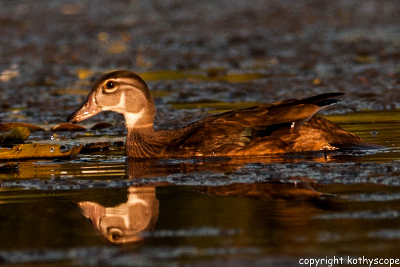
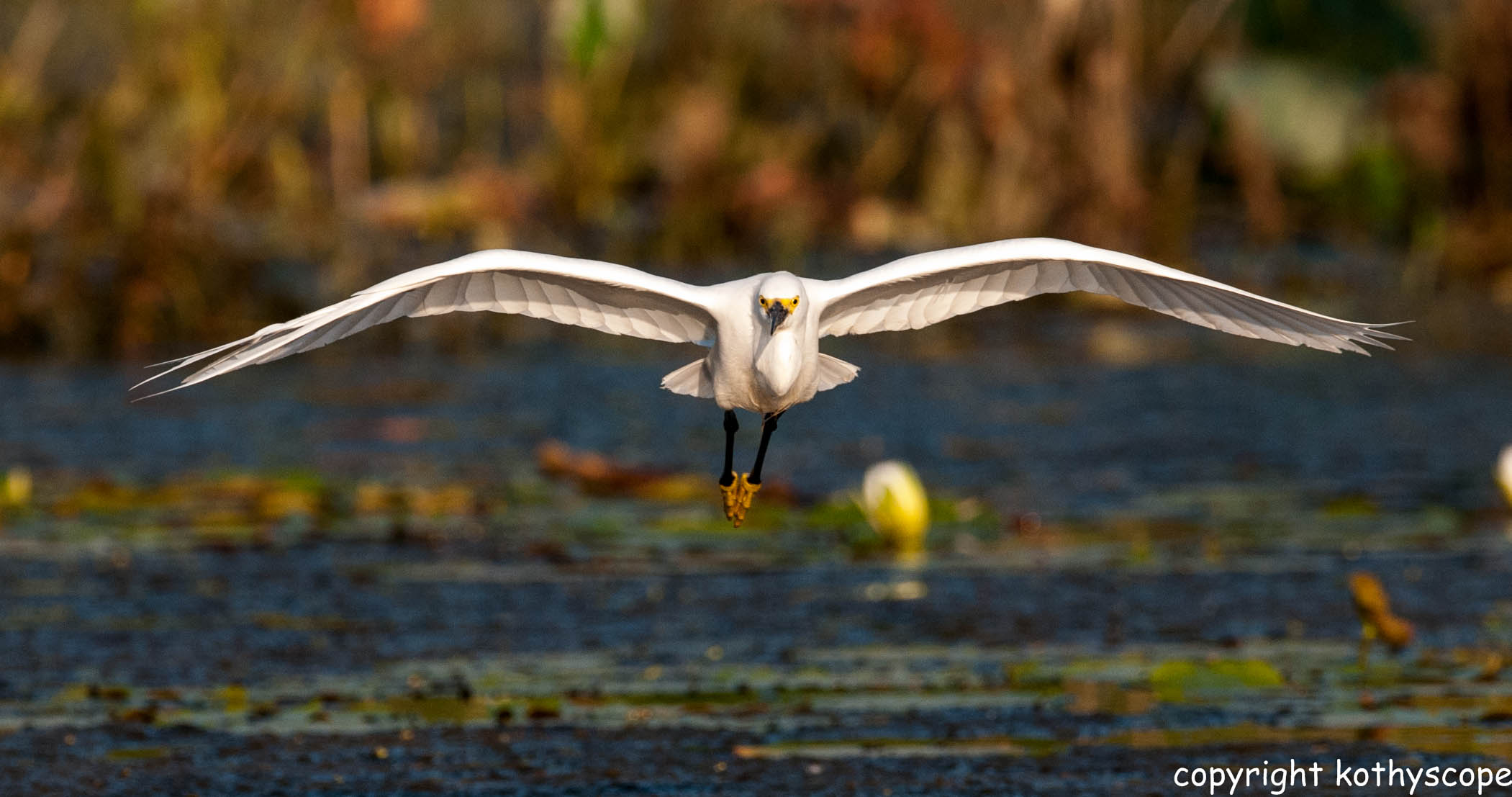
Plantings begin soon after excavation is completed. This new managed ecosystem, contains some 40 aquatic species, and is far more diverse than the willow-cattail wetlands common in North Texas with typically less than a dozen species. Greater plant diversity, including a new bass-bluegill fishery, attracts diverse wildlife, including some 140 species of resident and migratory birds such as great white egret, Ardea alba, snowy egret, Egretta thula, painted bunting, Passerina ciris, Northern Harrier hawk, Circus cyaneus, roseate spoonbills, Platalea ajaja, even the occasional bald eagle, Haliaeetus leucocephalus.


 Wetlands Fact Sheet USACE
RECREATION AT THE LOWER CHAIN OF WETLANDS
Experience Dallas' unique biodiversity which can easily be seen and enjoyed at the Lower Chain of Wetlands. Popular and low-impact recreation activities for the area include: hiking, biking, fishing, bird-watching, wildlife observation, wildflower and native species viewing, and photograpy. Dallas serves as a major fly-way for migrating birds and ducks, making this stop along the journey essential to their prosperity. Insects, butterflies, otters, raccoons, beavers, armadillos, and a host of other wildlife share this valuable resource areas that is functioning flood control doubling as a vast nature area with trails and recreation amenities.
Wood duck, Sriyida Sundar photo
Downy Egret in flight, Sriyida Sundar photo
DLower Chain of Wetlands with waterbirds, Sriyida Sundar photo